
LINDA ULTRA · US TIMBERLAND
Know your forest’s volume and value.
For the forest you own, manage or plan to buy. Review timber, forest health, wind damage and harvest detections. Use Linda Ultra to ask about a parcel and inspect the evidence behind its answers.
Linda Ultra is the generative AI and agent service. This demo uses Linda Scout parcel assessments and CollectiveCrunch forest layers.
Interactive example · no signup

Open on your phone
Scan to explore the US product tour.

For print, use at least 30 mm square and keep the white border.
CollectiveCrunch layers · US product
Find the timber. See the changes.
Explore eight views from the current US premium catalogue. Switch layers to see what each adds to a forest-owner or timber-sourcing decision.
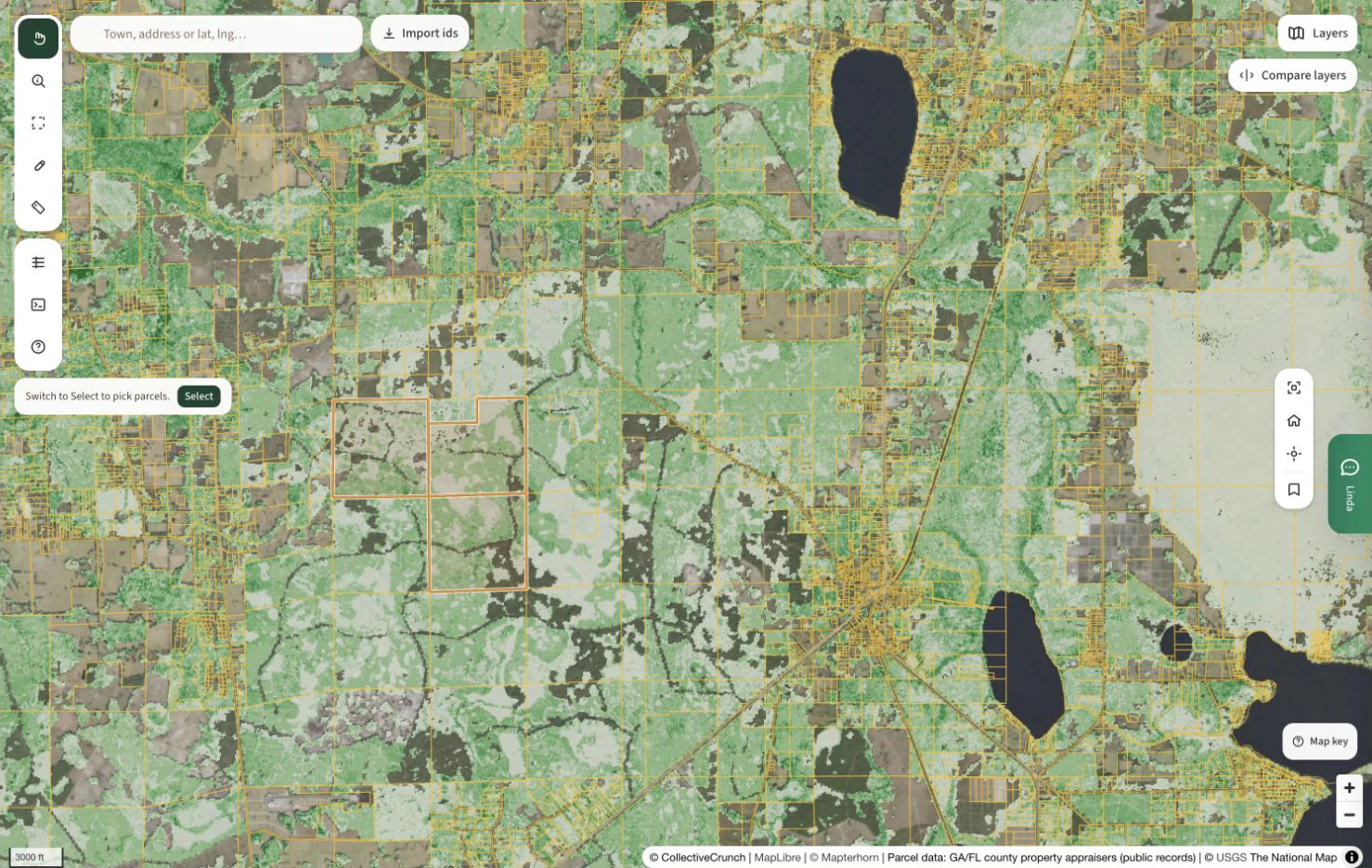
Timber weight
Find where the timber is.
Compare the mapped timber weight across stands, then examine sawtimber and pulpwood classes before planning a sale.
Use with the parcel inventory and timber-price assumptions. Weight alone does not establish saleable volume or a bid.
Review these layers on your land ↗Explore the financial example →Examples from northeast Florida. Coverage and dates differ by layer. These are captured views, not a live map of your holding.
Explore the recorded parcel workflow below ↓Linda Connect · Integration preview
Your forest data. In the AI you already use.
Use CollectiveCrunch forest data and Linda analysis inside your existing AI tools. Review holdings, prepare reports and feed your internal workflows.
Example request for Microsoft 365 Copilot
Summarize my US forest portfolio for our next review. Include timber estimates, valuation assumptions and source references.
What Linda brings to the task
Your saved US parcels, portfolio valuation results and the source disclosures attached to each holding.
Example request, not a recorded answer. The connection and available data are confirmed during setup.
Prepare your next portfolio review.
Prepare the numbers for your review in Microsoft 365. Linda supplies the holdings and valuation data; your assistant helps draft the briefing.
A Copilot Studio agent connects Linda to Microsoft 365 Copilot. Setup requires your Microsoft administrator and the appropriate licensing.
Discuss your connection Explore the data behind the answers ↓Access follows your Linda account permissions. Your chosen AI provider processes the information you request.
Client connections are being validated for customer rollout. Ask us to confirm availability for your tools, account and geography.
For your IT team
Linda Connect is the customer-facing name for Linda’s Model Context Protocol service, or MCP. It gives compatible AI tools access to permitted forest data and analysis. Microsoft 365 Copilot uses a Copilot Studio agent with tenant configuration. Claude and ChatGPT use custom connections subject to plan and admin settings. This preview does not establish marketplace listing, certification or completed client acceptance.
For forest owners and managers
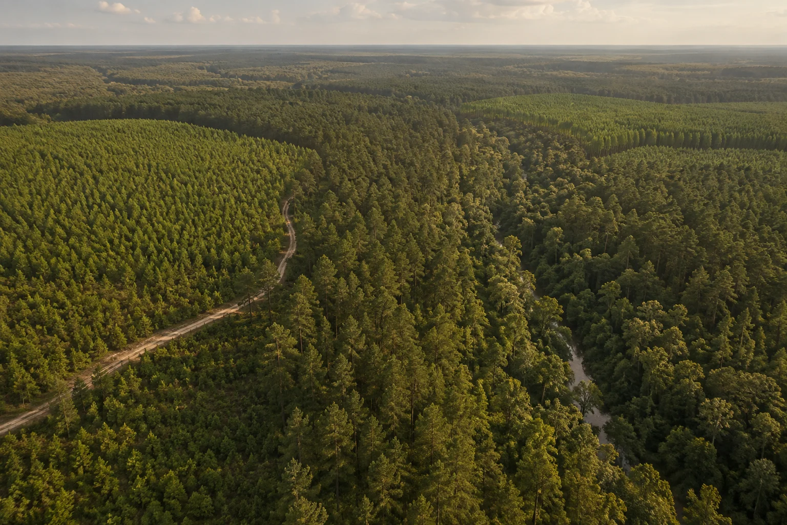
See the inventory across your holdings.
A holding can span many stands, species and stages of growth. Bring the available forest layers into your review, then use Linda Ultra to ask about inventory, timber value and nearby mills.
- Compare timber weight and forest composition across your land.
- Review standing timber estimates and their price assumptions.
- Locate stress, damage and harvest detections for field follow-up.
Sources and assumptions
Explore 570.9 acres in Alachua County.
Drag across the map. Switch the forest measure. Choose a question for Linda.
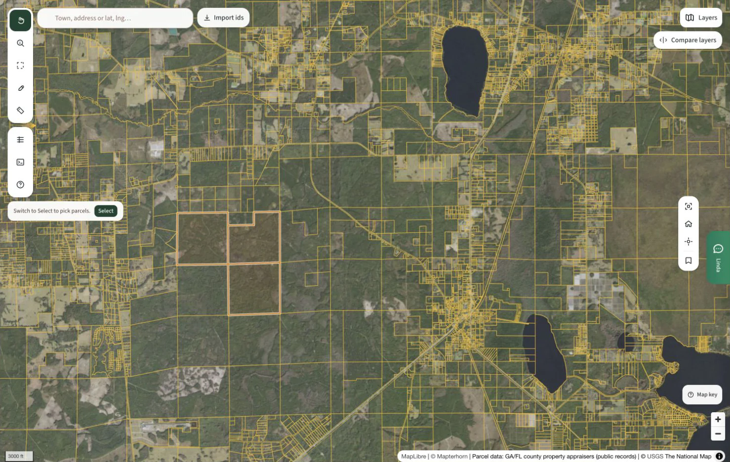
Captured CC layer · opacity 70% · coverage varies. © CollectiveCrunch · USGS · Mapterhorn · GA/FL county public records. Earlier capture from 6 September; some product labels have since changed.
Compare timber weight and softwood sawtimber.
Move the divider to compare the selected forest layer with aerial imagery. Ask Linda what is growing on the parcel.
Linda Ultra
Real parcel · recorded results
Parcel 16940-000-000 · 570.9 acres
Evidence used · Saved parcel inventory
Mostly softwood sawtimber and pulpwood.
~82% softwood share
Softwood sawtimber and pulpwood account for roughly 82% of recorded standing volume. The nearest sawmill in the saved analysis is 14 straight-line miles from the parcel.
Sources and assumptions
Interactive demo of recorded Linda results, not live generation. Valuation and mill queries captured 6 September 2026; inventory and review guidance use the saved brief.
Forest income and value
Compare returns from forest management.
Compare the financial case for inventory-led decisions, forest-health management and wind-damage recovery.
Inventory → treatment choice → future timber value
Compare thinning options and future timber value.
Inventory helps a forester compare stands and plan a thinning. Better tree selection can improve the value left growing for the final harvest.
Use volume and species layers to plan field assessment, then have a forester select trees for thinning.
Illustrative area, not a mapped holding. Scale the study result only to acres suited to the same treatment.
Optional, additional to costs already in the study. Enter a current evaluation or data quote. Unentered costs remain unknown.
Additional discounted return
$2,500
Published difference: $25.00 per treated acre
Net present value at a 5% discount rate, before additional evaluation costs. This is a rotation-level difference, not annual cash income.
- Marked thinning, NPV
- $94,100
- Operator-selected thinning, NPV
- $91,600
- Additional value
- $2,500
- Additional evaluation costs
- Not entered
The study difference leaves $25.00 per treated acre for additional costs before the incremental benefit is exhausted.
Review the opportunity on your land ↗A north Florida study of three pine stands reports NPV of $941/acre for marked thinning and $916/acre for operator selection, a $25 difference. The calculator scales that published comparison; it does not claim remote sensing caused the gain.
Research example, not a measured Linda customer outcome. Keep the study’s forest type, treatment, prices and discount rate in view. Data identifies where to investigate; the management action produces the return.
These are separate comparisons with different time horizons. Do not add them into a total ROI or count the same trees twice.
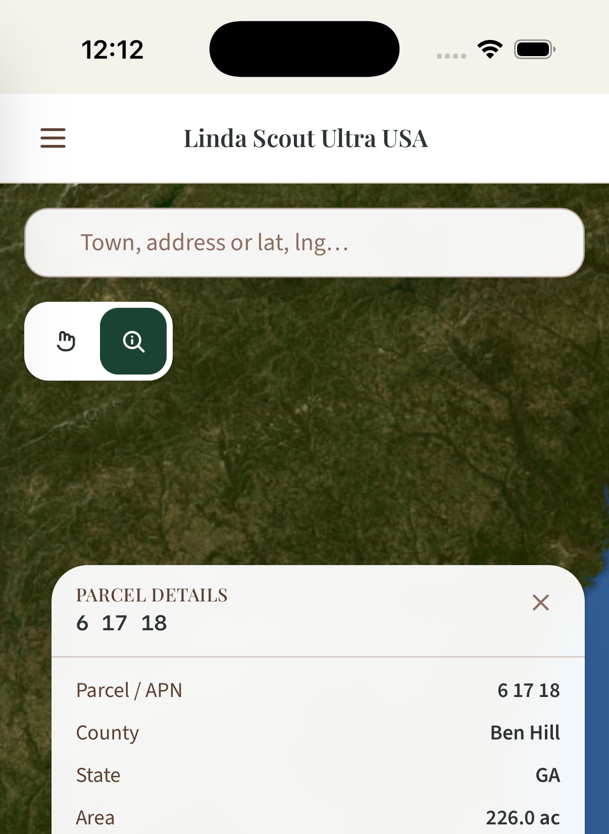
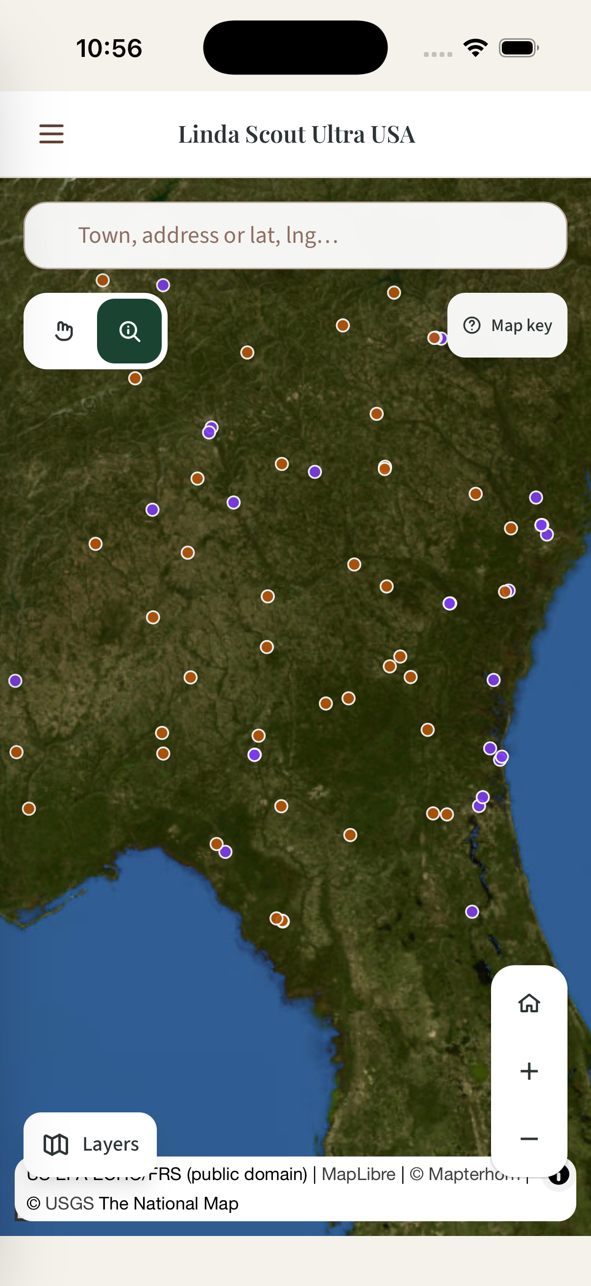
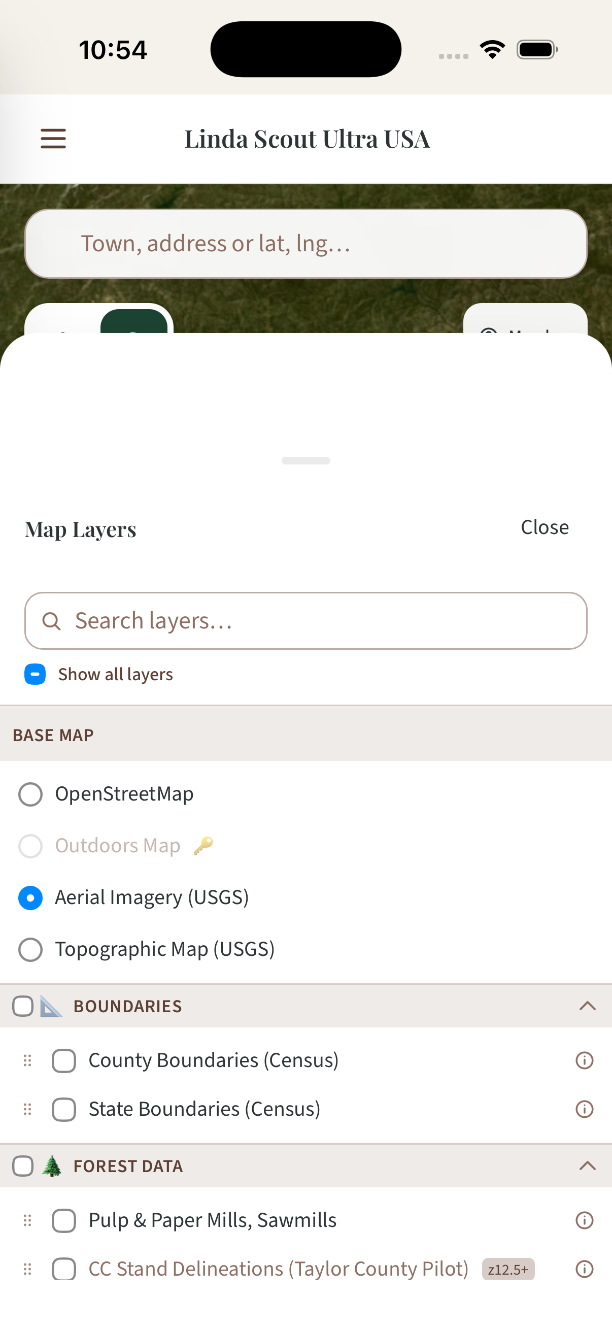
Mill locations on iPhone
Linda Scout on iPhone
Inspect parcel details, switch map layers and locate mills in the iPhone app. These captures show the signed-in US app. The parcel view is cropped to exclude personal information.
Ask our team about mobile access. ↗Sources and assumptions
See the full parcel review.
Four product views, from forest layers to a saved investment brief.
Compare forest volume.
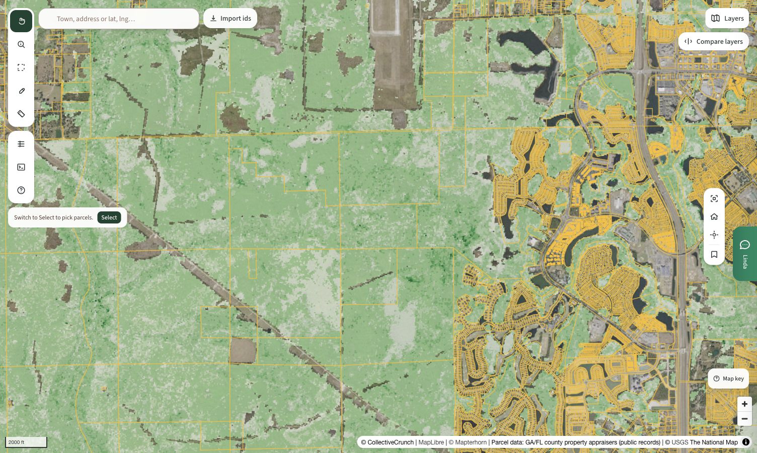
Compare aerial imagery with forest-volume layers to see how the timber pattern varies across the area.
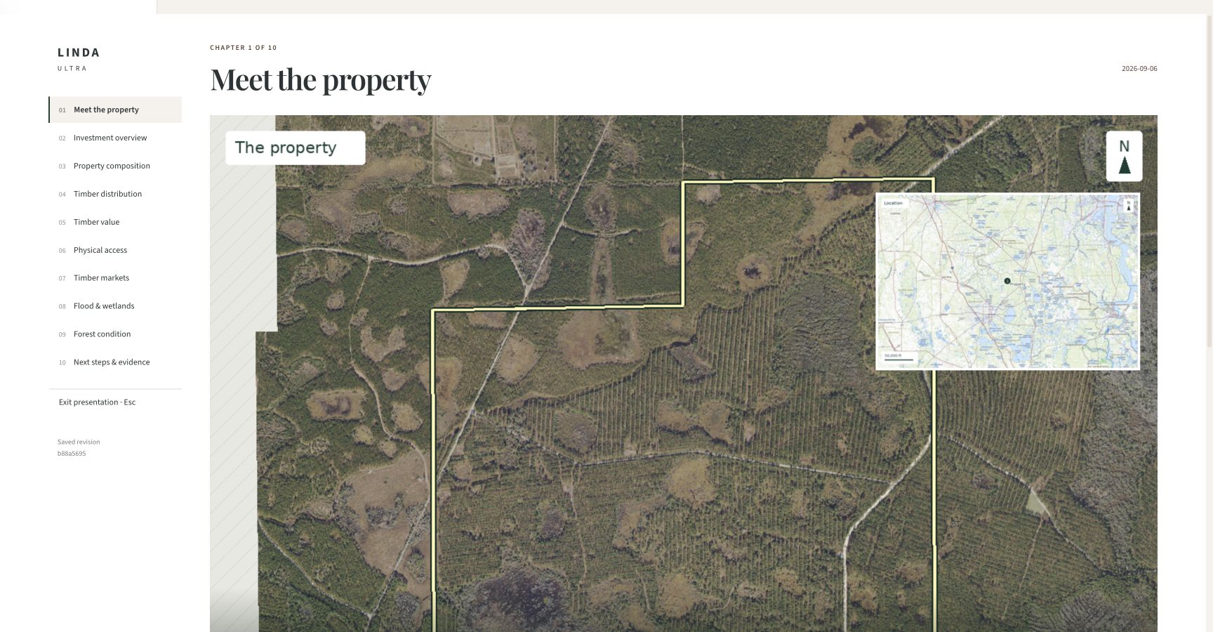
Inspect the parcel.
See the boundary and surrounding landscape before moving into the timber and valuation evidence.
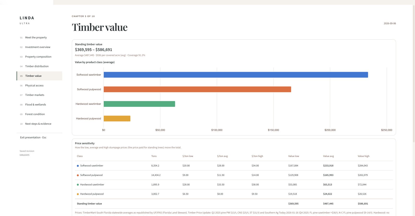
Review the timber estimate.
Compare the standing-timber estimate by product class and see how price assumptions change the result.
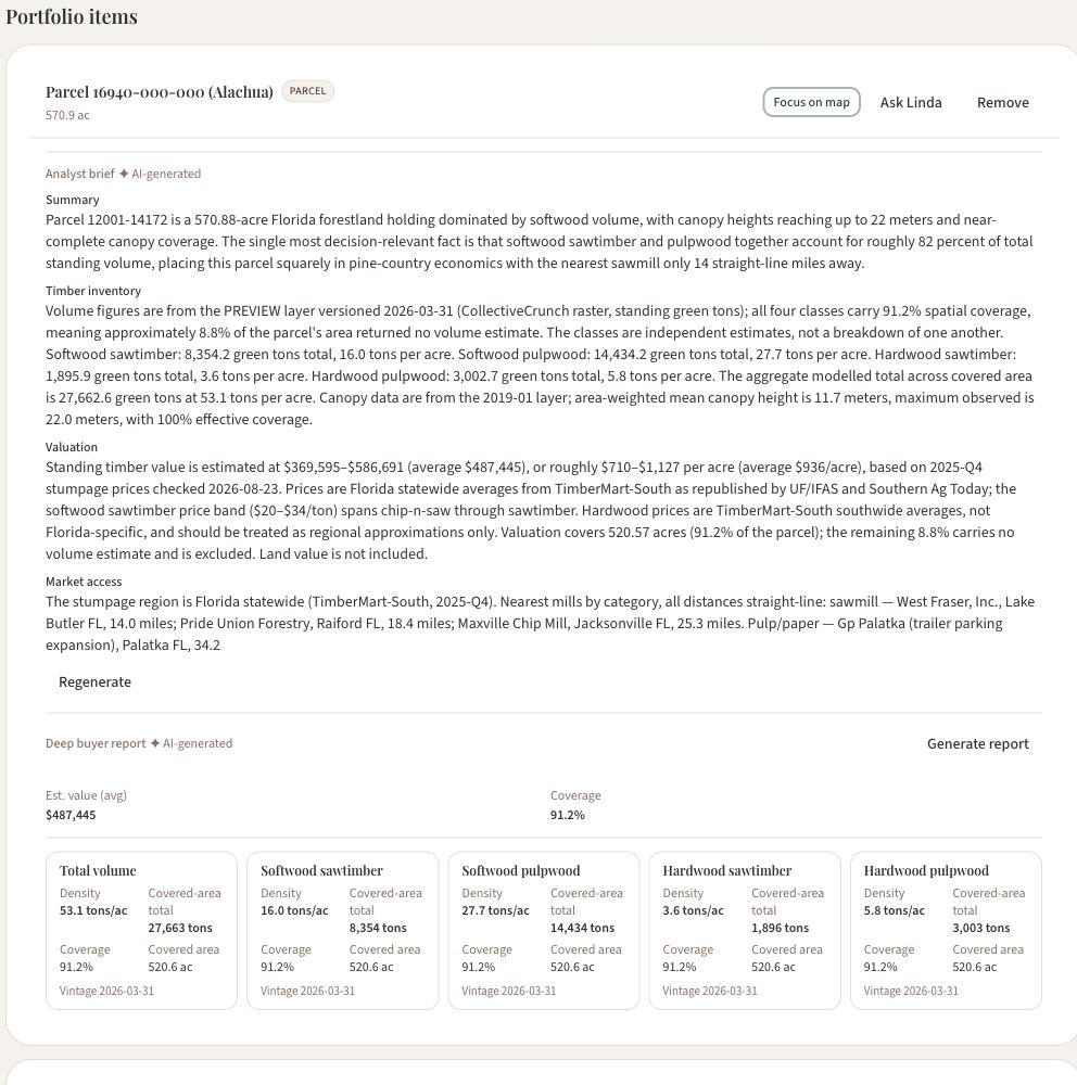
Review the saved holding.
Read the holding’s AI summary alongside its inventory and timber estimate.
About this demo
What am I looking at in this example?
A real Florida parcel, captured CollectiveCrunch layers and recorded Linda Ultra agent results. The parcel is an example, not a verified sale listing.
Can I use this to value a holding or a purchase?
Use it for an initial review. The example estimates standing timber from modelled inventory and price assumptions. Land value, current field conditions and haul routes require a separate assessment.
Can we look at the areas my team works in?
Bring your target geography and parcel questions to the demo. The team can discuss which layers are available and how they fit your workflow.
Can our team use Linda through Copilot, Claude or ChatGPT?
Linda Connect is the integration offering for bringing Linda data and analysis into compatible AI tools. Microsoft 365 Copilot uses Copilot Studio; Claude and ChatGPT use custom connections. Customer connections are being validated. Contact us to confirm your setup and available data.
Review your forest holdings with our team.
Tell us where you work and what you need to assess. We’ll review the available forest data and discuss how Linda can fit your team’s AI tools and workflows.
Discuss a parcel with usWhat we’ll cover
- Your existing holdings or acquisition area and available layers
- The inventory and valuation questions you need answered
- Your team’s AI tools and a Linda Connect integration demo